Point Pelee National Park sits at the southernmost point of the Canadian mainland, at 1118 Point Pelee Drive, Leamington, ON. Parks Canada describes it as Canada's second-smallest national park. It is known for bird migration, with more than 390 species recorded in the Point Pelee Birding Area. It is also a dark sky preserve. This guide covers trails, seasons and planning details drawn from Parks Canada information.
Where Point Pelee is and what it is known for
Point Pelee National Park is at the southernmost point of the Canadian mainland. The park address is 1118 Point Pelee Drive, Leamington, ON. Parks Canada describes Point Pelee as Canada's second-smallest national park. Driving times and directions from your accommodation are shown on the booking site, or you can confirm them with the hotel.
The park sits on major migratory flyways on the north shore of Lake Erie. It acts as a 'migrant trap' for birds moving through the region. More than 390 bird species have been recorded in the Point Pelee Birding Area.
Point Pelee is also a dark sky preserve. The park runs Dark Sky Nights programs after dark. Program dates and times are not listed here, so confirm them before you plan an evening visit.
Seasons, off-peak operations and access notes
Spring and fall migration are the main seasons at Point Pelee. The spring peak comes in May, when the park hosts the Festival of Birds. Festival dates are not listed in this guide, so confirm them before you book travel. Hotel availability for May is shown on the booking site.
The park runs in off-peak operations from November 1 to March 31. oTENTik A-frame cabins in Camp Henry are available to book all year.
Road work and temporary closures can affect access to the park from time to time, and Parks Canada posts them as alerts. Check those alerts before you travel, and confirm the route from your accommodation with the hotel.
The Tip Trail, the shuttle and the Marsh Boardwalk
The Tip Trail is a 1 km loop of about 20 to 40 minutes. It leads to the most southern point of mainland Canada. A shuttle runs from the Visitor Centre to the Tip from April to October. The shuttle is wheelchair and walker accessible. Shuttle schedules, parking and other visit details are not covered here, so confirm them before you travel.
The Marsh Boardwalk is a 1 km loop that takes about 45 minutes. It crosses the park's most diverse habitat, with cattail mats, turtles and lily pads. An observation tower with telescopes looks over the marsh. The tower is not accessible.
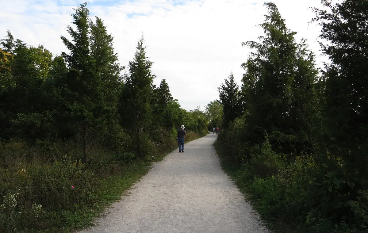
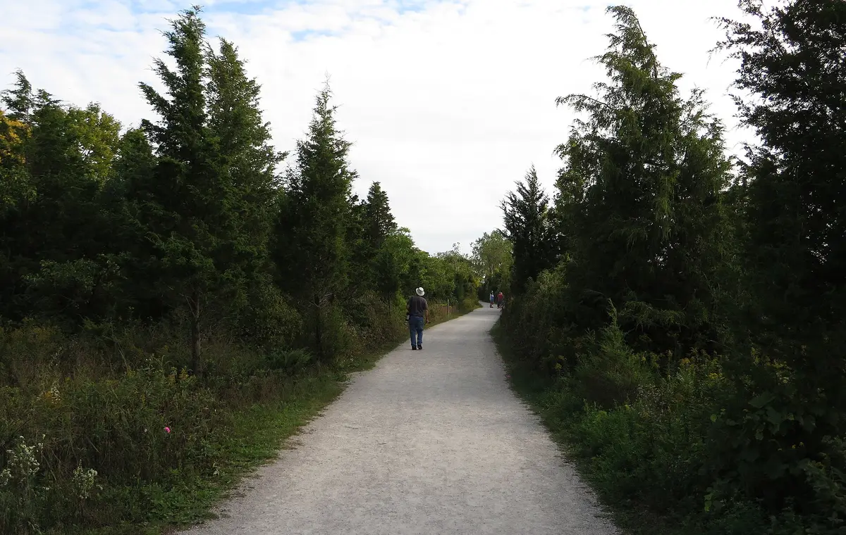
Park trails are 1.5 m wide and surfaced with crushed gravel and boardwalks. The trails are suitable for strollers and wheelchairs.
Forest trails and cycling routes
The Woodland Nature Trail is a 2.75 km loop of about 1 hour. It passes through the park's oldest forest habitat. A self-guided booklet is available at the Visitor Centre during operating hours.
The Chinquapin Oak Trail is a 4 km loop of about 2 hours. It runs through mixed dry forest that includes Chinquapin Oak. Access is from the Visitor Centre parking lot or the White Pine picnic area.
The park has more than 12 km of hiking, walking and cycling trails. The Centennial Hike and Bike Trail is a 6 km trail between the park entrance and the Visitor Centre. The Anders and Chinquapin cycling loops close to bikes during spring birding season, mid-April through May. If you plan to cycle in spring, check which routes are open before you arrive.
Planning a visit around trails and seasons
The shuttle to the Tip runs from the Visitor Centre from April to October. The Tip Trail is a 1 km loop to the most southern point of mainland Canada. The Chinquapin Oak Trail can be reached from the Visitor Centre parking lot or the White Pine picnic area. A self-guided booklet for the Woodland Nature Trail is available at the Visitor Centre during operating hours.
Spring and fall migration are the main seasons. The spring peak is in May, during the Festival of Birds. Cyclists should note that the Anders and Chinquapin cycling loops close to bikes from mid-April through May. Visitors interested in the night sky can look into the Dark Sky Nights programs after dark.
For an overnight stay inside the park, oTENTik A-frame cabins in Camp Henry are available to book all year. Hotel options in the area, with rates and amenities, are shown on the booking site. Parking, check-in times and other policies should be confirmed with the hotel.
Key points
- Point Pelee National Park is at the southernmost point of the Canadian mainland, at 1118 Point Pelee Drive, Leamington, ON.
- More than 390 bird species have been recorded in the Point Pelee Birding Area, and spring migration peaks in May with the Festival of Birds.
- The park has more than 12 km of trails, and trails are 1.5 m wide and suitable for strollers and wheelchairs.
- The park runs in off-peak operations from November 1 to March 31.
- Road work and temporary closures can affect access to the park, so check the Parks Canada alerts before you travel.
Frequently asked questions
When is the main birding season at Point Pelee?
Spring and fall migration are the main seasons. The spring peak is in May, when the park hosts the Festival of Birds.
Are the trails accessible?
Park trails are 1.5 m wide with crushed gravel and boardwalks, and suitable for strollers and wheelchairs. The Tip shuttle is wheelchair and walker accessible. The Marsh Boardwalk tower is not accessible.
Can I stay overnight inside the park?
oTENTik A-frame cabins in Camp Henry are available to book all year. Confirm booking details before you travel.
Where can I book a hotel near Point Pelee National Park?
You can compare hotel rates on Trip.com. Confirm parking, check-in times and other policies with the hotel.
Sponsored content. wiikiro.com earns a commission when you book through links on this page, and that affects which hotels we feature and in what order. We do not take bookings. Destination details come from tourism board, park and attraction websites as of November 10, 2026; confirm current rates, fees and cancellation terms on the booking site before you pay.